Red Bluff Camp Site, Alpine National Park
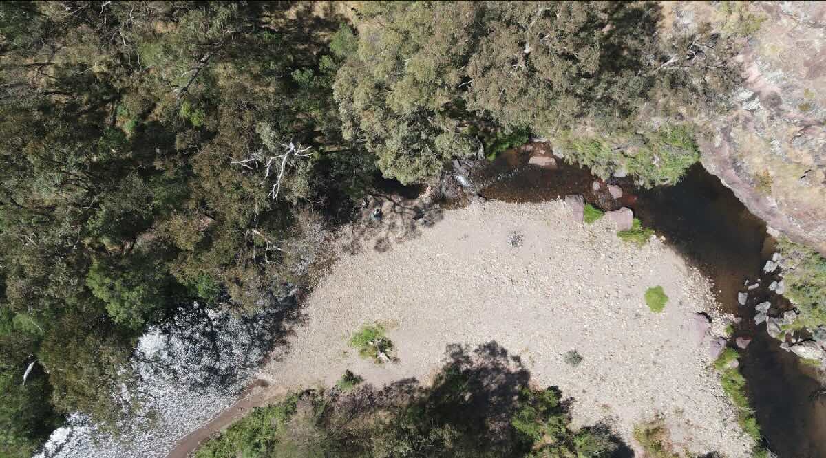
Red Bluff Camp Site is a spectacular, high-altitude bush camp for the dedicated 4WD adventurer, offering some of the most breathtaking panoramic views in the Victorian High Country. Perched in a remote corner of the Alpine National Park, this is not a destination you stumble upon by chance. Access is strictly for well-equipped 4WD vehicles with experienced drivers, via iconic and challenging tracks like the Bluff Track. These routes are steep, rocky, and often narrow, demanding low-range gearing and careful navigation. They are also subject to seasonal closures, typically from June to November, making this a prime summer and autumn adventure. The campsite itself is a small, exposed clearing near the striking geological feature of Red Bluff, providing an unparalleled sense of being on top of the world.This is a primitive campsite in every sense of the word. There are absolutely no facilities—no toilets, no water, no tables, and no bins. It is a location that demands complete self-sufficiency and a rigorous commitment to ‘leave no trace’ camping. Visitors must bring everything, including a portable toilet system, all drinking water, and the means to carry out all rubbish. As it’s located within the Alpine National Park, pets and generators are strictly prohibited to preserve the fragile alpine ecosystem and its profound tranquility. Due to the exposed, high-altitude location, open fires are also forbidden; cooking must be done on a fuel stove. The reward for this extensive preparation is an unforgettable experience. The sunsets and sunrises over the endless mountain ranges are simply awe-inspiring. It’s a fantastic base for photographers and hikers wanting to explore nearby peaks like The Bluff and Mount Eadley Stoney. For those who seek true solitude and are equipped for the challenge, Red Bluff offers a raw, powerful, and deeply rewarding connection to the wild heart of the Alps.
Red Bluff Camp Site – VIC Location Map
- Name and Address: Red Bluff Camp Site, Bluff Track, Crookayan, VIC 3858, Australia
- GPS Coordinates: -37.51955450572412, 146.6217249727575
- Website: Parks Victoria – Alpine National Park
Campground Information & Features
- Location: High altitude, remote location in the Alpine National Park, off the Bluff Track.
- Site Suitable For: Tents and swags only. Extremely limited and exposed space.
- Road Access: 4WD only. Very difficult, steep, rocky tracks subject to seasonal closure.
- Site Surface: Small, natural, rocky clearing.
- Camping Permitted: Yes, free dispersed camping.
- Maximum Overnight Stays: Standard national park limits apply.
- Facilities: None.
- Potable Water: No. You must carry in all water.
- Mobile Phone Coverage: Unlikely. A satellite communication device is essential.
- Onsite Public Toilets: No. A portable toilet is mandatory.
- Rubbish Bins: No. All rubbish must be carried out.
- Open Fires: Prohibited. Fuel stoves only.
- Generator Use: Prohibited.
- Number of Sites Available: Very limited space for one or two small tent setups.
- Essentials to Bring: All water, portable toilet, fuel stove, alpine-rated tent, recovery gear, detailed maps, PLB/sat phone.
- Pet Friendly: No. Pets are strictly forbidden in the Alpine National Park.
- Fishing: Not applicable.
- Short Walks: This is a key location for serious alpine hiking, including sections of the Bluff Track.
Nearby Amenities & Attractions (All are very distant)
- Local Pubs:
- Dargo Hotel (Dargo) – Approx. 60 km (via very challenging 4WD tracks)
- Licola General Store (Licensed) – Approx. 60 km (via very challenging 4WD tracks)
- Kevington Hotel (Kevington) – Approx. 65 km (via very challenging 4WD tracks)
- Places to Eat:
- The nearest food outlets are in Dargo, Licola, or Mansfield, all of which are several hours’ drive away on difficult tracks.
- Local Attractions:
- The Bluff Summit
- Mount Eadley Stoney
- Historic cattlemen’s huts (e.g., Bluff Hut, Lovicks Hut)
- Nearest Caravan Parks:
- Licola Caravan Park – Approx. 60 km
- Dargo River Inn & Tourist Park – Approx. 60 km
- Next Free Camps:
- Bluff Hut Camping Area – Nearby
- Lovicks Hut Camping Area – Further along the track
- Horseyard Flat – Approx. 25 km (4WD only)
- Nearest Dump Points:
- Heyfield or Maffra are the closest major towns with facilities, over 100km away.
- Nearest Petrol Station:
- Licola or Dargo (unreliable hours, expensive) – Approx. 60 km
- Mansfield or Heyfield are the last reliable fuel stops.
- Drinking Water Resupply:
- You must be self-sufficient. The last reliable water is in major towns like Heyfield or Mansfield.
- Nearest Public Toilets (offsite):
- Bluff Hut and Lovicks Hut have non-flush toilets.
Seasonal Weather Forecast: Alpine High Plains (Bluff Area)
- Summer (Dec-Feb): Highly unpredictable. Can be warm and sunny, but can change to cold, wet, and extremely windy with no warning. High fire danger.
- Autumn (Mar-May): Often the most stable and ideal time to visit, with clear, crisp days and cold nights.
- Winter (Jun-Aug): Completely inaccessible. Tracks are closed and the area is covered in deep snow.
- Spring (Sep-Nov): Tracks remain closed until snow has cleared and they are assessed as safe, often not opening until late November. Cold, windy, and unpredictable.