Paradise Dam Recreational Park QLD – **CURRENTLY CLOSED** (Sunwater Alert)
IMPORTANT UPDATE: CLOSED UNTIL FURTHER NOTICE
As of early 2024, Sunwater (the managing authority) has advised that the Paradise Dam Recreational Park, including the lake, boat ramp, and **all public road access, is CLOSED until further notice.** This closure is due to significant dam safety project works. Visitors MUST NOT attempt to access the area. Please check the official Sunwater website for the most current alerts and information before planning any travel to this region.
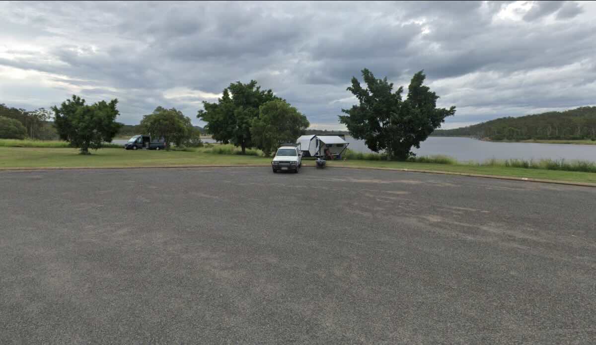
When it was open, the Paradise Dam Recreational Park, located near Biggenden in the North Burnett region of Queensland, was a popular and peaceful bush camping destination. Set on the banks of the Burnett River (Lake Paradise), it was named after the historic gold-mining town of Paradise, which now lies submerged beneath the dam’s waters. The park offered a spacious, natural setting for camping, boating, and fishing. It was a well-regarded spot for anglers targeting Bass, Barramundi, and Saratoga, and its remote location provided an excellent ‘get away from it all’ experience. The area was particularly suited to self-sufficient campers who enjoy basic amenities and a natural setting. However, due to the ongoing dam works, this recreational area is currently inaccessible to the public.
The information below describes the facilities and local area as they were *prior* to the closure. This information is for reference only and does not imply the park is open. When operational, the campground was known for its basic, low-cost sites managed by an on-site caretaker. Facilities were limited, with a strong emphasis on self-sufficiency. Notably, only non-potable water was available, and open fires were strictly prohibited. The park’s closure has also meant the loss of access to the boat ramp, which was a key drawcard for boat-based anglers. Travellers looking to camp in the region are advised to use alternative sites in nearby towns such as Biggenden, Childers, or at other recreational dams like Mingo Crossing.
Paradise Dam Recreational Park – QLD Location Map
Park Information
Name: Paradise Dam Recreational Park
Status: CLOSED UNTIL FURTHER NOTICE
Address: Off Paradise Dam Road, via Coringa QLD 4621 (Road access is CLOSED)
Managed By: Sunwater
Website: https://www.sunwater.com.au/dams/paradise-dam/ (Check here for official updates)
Location and Location Map
GPS Coordinates: -25.35743, 151.91648
Site Details (Prior to Closure)
- Location: Remote bush setting on the banks of the Burnett River (Lake Paradise), approx. 30-40 mins from Biggenden.
- Site Suitable For: Tents, camper trailers, caravans, motorhomes.
- Road Access: ROAD CURRENTLY CLOSED. (Previously unsealed and gravel roads, condition variable).
- Site Surface: Grass and dirt sites in an open, undefined area.
Facilities and Features (Prior to Closure)
NOTE: The entire park and all facilities are currently INACCESSIBLE.
- Picnic Tables: Yes, in day-use areas.
- Potable Water: NO. Only non-potable water was available. Campers were required to bring all drinking water.
- Mobile Phone Coverage: Very limited to non-existent (Telstra might have patchy service in high spots, but not reliable).
- TV Reception: Very poor or non-existent.
- BBQ’s: Yes, communal gas barbecues were available.
- Onsite Public Toilets: Yes, environmentally-friendly toilets (no showers) were available.
- Ullage (Dump Point): No.
- Drive Through Sites: No, but the area was open and generally suitable for larger rigs to manoeuvre.
- Rubbish Bins: Yes, bins were available.
- Open Fires: NO. Open fires were strictly prohibited at all times.
- Generator Use: Yes, generators were generally permitted during daylight hours (e.g., 8 am – 7 pm).
- Essentials to Bring: ALL drinking water, own shower (if required), insect repellent, all camping supplies.
- Pet Friendly: Yes, pets were allowed under conditions (on leash, attended at all times).
- Fishing: Yes, was very popular (boat ramp is now closed).
- Short Walks: Yes, informal walks around the dam foreshore.
Local Amenities (Nearest Town: Biggenden)
Pubs
- Commercial Hotel Biggenden: (Approx. 35 km) – Historic pub in the main street of Biggenden.
- Grand Hotel Biggenden: (Approx. 35 km) – Another local pub in town.
- (Note: Distances are approximate from the dam, via roads that are now closed).
Places to Eat
- Biggenden Bakery: (Approx. 35 km) – Bakery in the main street.
- Commercial Hotel Biggenden: (Approx. 35 km) – Pub meals.
- Various Cafes in Biggenden: (Approx. 35 km).
Local Attractions
- Mount Walsh National Park: (Approx. 40 km) – Known for its rugged peaks and bushwalking (check Parks QLD for access).
- Chowey Bridge: (Approx. 30 km) – Impressive historic concrete railway bridge near Biggenden.
- Biggenden Historical Society Museum: (Approx. 35 km) – Local history museum.
- Coalstoun Lakes National Park: (Approx. 50 km) – Features two ancient volcanic craters.
- Childers Historic Town: (Approx. 70-80 km) – Historic streetscape with museums and galleries.
Nearest Caravan Parks (Alternatives)
- Mountain View Caravan Park: (Approx. 35 km in Biggenden) – Council-run park with cabins, powered and unpowered sites.
- Mingo Crossing Caravan and Recreation Park: (Approx. 70 km) – Popular park on the Burnett River, upstream from Paradise Dam.
Nearest Free Camps (Alternatives)
- Biggenden RV Stopover: (Approx. 35 km in Biggenden) – 72-hour stop for fully self-contained vehicles only.
- Apple Tree Creek Rest Area: (Approx. 65 km near Childers) – 20-hour stop, suitable for self-contained vehicles.
Nearest Dump Points
- Biggenden Dump Point: (Approx. 35 km) – Located at 19 Walsh Street, Biggenden (near Mountain View Caravan Park).
- Childers Public Dump Point: (Approx. 70 km) – Located on Crescent Street, Childers.
Nearest Petrol Stations
- BP Biggenden: (Approx. 35 km) – 16 Alfred Street, Biggenden.
- Multiple stations in Childers: (Approx. 70 km) – Shell, BP, Caltex located on the Bruce Highway.
Nearest Drinking Water Resupply
- Childers Public Water Tap: (Approx. 70 km) – Located on Crescent Street (near the dump point).
- (No confirmed public potable water refill tap found in Biggenden).
Nearest Public Toilets (Nearest Town)
- Biggenden Dump Point: (Approx. 35 km) – Public toilets available at this location.
- Various in Biggenden township: (Approx. 35 km) – e.g., at parks.
Seasonal Weather Forecast: Biggenden Area (Wide Bay & Burnett Inland)
Summer (December – February)
- Hot and relatively humid, with the highest chance of rainfall and thunderstorms.
- Mean Max: 31°C – 33°C
- Mean Min: 19°C – 21°C
- Mean Rain (mm): 85-110 mm
- Mean Rain Days: 9-10
Autumn (March – May)
- Warm days becoming milder, with lower humidity and pleasant nights. Rainfall starts to decrease.
- Mean Max: Cools from 31°C down to 25°C.
- Mean Min: Cools from 19°C down to 11°C.
- Mean Rain (mm): 30-80 mm
- Mean Rain Days: 5-8
Winter (June – August)
- Mild, sunny, and dry days with cool to cold nights. Frost can occur in low-lying areas.
- Mean Max: 22°C – 25°C
- Mean Min: 7°C – 8°C
- Mean Rain (mm): 25-30 mm
- Mean Rain Days: 4-6 (Driest period)
Spring (September – November)
- Warm to hot and sunny days, with cool nights warming up. Rainfall is variable but generally low until late Spring.
- Mean Max: Warms from 28°C up to 32°C.
- Mean Min: Warms from 11°C up to 17°C.
- Mean Rain (mm): 25-75 mm
- Mean Rain Days: 5-8