Edi Rest Area, Free King River Camping in Victoria’s High Country
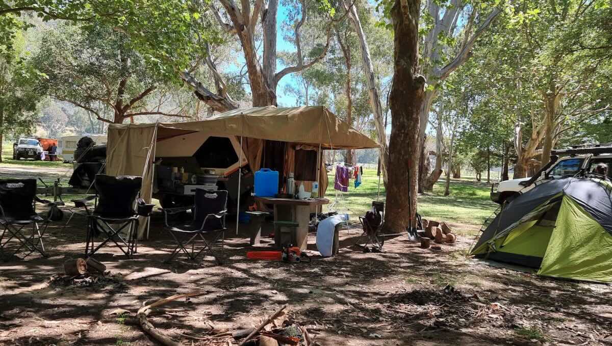
Nestled in the heart of Victoria’s spectacular King Valley, the Edi Rest Area is one of the region’s most popular and beloved free camping spots. This large, picturesque reserve offers a magnificent setting right on the banks of the beautiful King River, making it a paradise for families, anglers, and travellers exploring the High Country’s gourmet food and wine trail. The campground is spread across a vast, flat, and grassy area, shaded by a stunning canopy of mature, decades-old trees. This provides an abundance of fantastic sites, with plenty of room for all setups, from the largest motorhomes and big rigs to smaller campervans and tents. The atmosphere is famously relaxed and friendly, a place where you can unwind to the soothing sounds of the river and the chorus of native birdlife.
The main attraction is undoubtedly the crystal-clear King River, which provides a natural playground for all ages. It’s a popular spot for a refreshing swim on a hot summer’s day, a leisurely paddle in a kayak, or for casting a line in pursuit of the local trout. The campground itself is exceptionally well-serviced for a free site, featuring clean flushing toilets and picnic facilities. Its prime location makes it the perfect basecamp for indulging in the King Valley’s renowned attractions. World-class wineries like Pizzini and Dal Zotto are just a short, scenic drive away in Whitfield, as are charming country pubs and cafes. The stunning natural beauty of Paradise Falls and Powers Lookout are also within easy reach for a day trip. For an unbeatable free camping experience that combines natural beauty, fantastic recreation, and a perfect location for exploring one of Victoria’s premier food and wine regions, the Edi Rest Area is a must-visit destination.
Edi Rest Area – VIC Location Map
Campground Information
-
- Name: Edi Rest Area and Free Camping site
- Address: Porters Ln, Edi VIC 3678
- GPS: -36.64785772865756, 146.42254734396965
Location Map
Site Details
- Location: Riverside reserve in the King Valley.
- Site Suitable For: Caravans, Motorhomes, Big Rigs, Camper Trailers, Tents.
- Road Access: Sealed road.
- Site Surface: Mostly grass.
- Camping Permitted: Yes, free camping (donations are appreciated).
- Maximum Overnight Stays: Please observe local signage, short stays are encouraged.
- Facilities: Flushing toilets, picnic tables. No power or showers.
- Potable Water: No. You must bring your own drinking water.
- Mobile Phone Coverage: Good for Telstra, can be patchy for other carriers.
- TV Reception: Good digital TV reception.
- Onsite Public Toilets: Yes, flushing toilets.
- Rubbish Bins: Yes.
- Open Fires: Permitted in contained fire pits, subject to seasonal fire restrictions. BYO firewood.
- Generator Use: Permitted, but please be considerate of other campers.
- Number of Sites Available: Very large, unmarked area with plenty of room.
- Essentials to Bring: Drinking water, firewood, fishing gear, kayak.
- Pet Friendly: Yes, pets are welcome on a lead.
Activities
- Fishing: The King River is popular for trout fishing.
- Short Walks: Enjoy leisurely walks along the riverbank.
- Kayaking & Swimming: The river is a beautiful spot for water activities.
Local Amenities
- Local Pubs:
- Mountain View Hotel (Whitfield) – Approx. 15 km
- Moyhu Hotel (Moyhu) – Approx. 12 km
- The Plough Inn (Tarrawingee) – Approx. 35 km
- Places to Eat:
- The Whitty Cafe (Whitfield) – Approx. 15 km
- Pizzini Wines (cellar door with food platters) – Approx. 18 km
- Dal Zotto Wines Trattoria (Restaurant) – Approx. 16 km
- Local Attractions:
- King Valley Wine Region – You are in it!
- Powers Lookout – Approx. 30 km
- Paradise Falls – Approx. 40 km
- Wangaratta city centre – Approx. 40 km
- Nearest Caravan Parks:
- Valley View Caravan Park (Whitfield) – Approx. 15 km
- Painters Island Caravan Park (Wangaratta) – Approx. 40 km
- Next Free Camps:
- Lake William Hovell – Approx. 45 km
- Tolmie Recreation Reserve – Approx. 55 km
- Nearest Dump Points:
- Whitfield Public Dump Point – Approx. 15 km
- Wangaratta Showgrounds Public Dump Point – Approx. 40 km
- Nearest Petrol Station:
- Moyhu – Approx. 12 km
- Whitfield – Approx. 15 km
- Drinking Water Resupply:
- Available in Whitfield or Moyhu.
- Public Toilets:
- Available onsite.
Seasonal Weather Forecast
- Summer (Dec-Feb): Warm to hot, perfect for swimming in the river, with average temperatures of 15-31°C.
- Autumn (Mar-May): Mild, sunny days and cool nights, the peak season for autumn colours in the vineyards, averaging 9-24°C.
- Winter (Jun-Aug): Cold and crisp, with frequent frosts and foggy mornings, averaging 3-14°C.
- Spring (Sep-Nov): Mild and pleasant, with the countryside green and lush, averaging 8-22°C.