Coopers Campground, Free Howqua River Camping & High Country Adventure
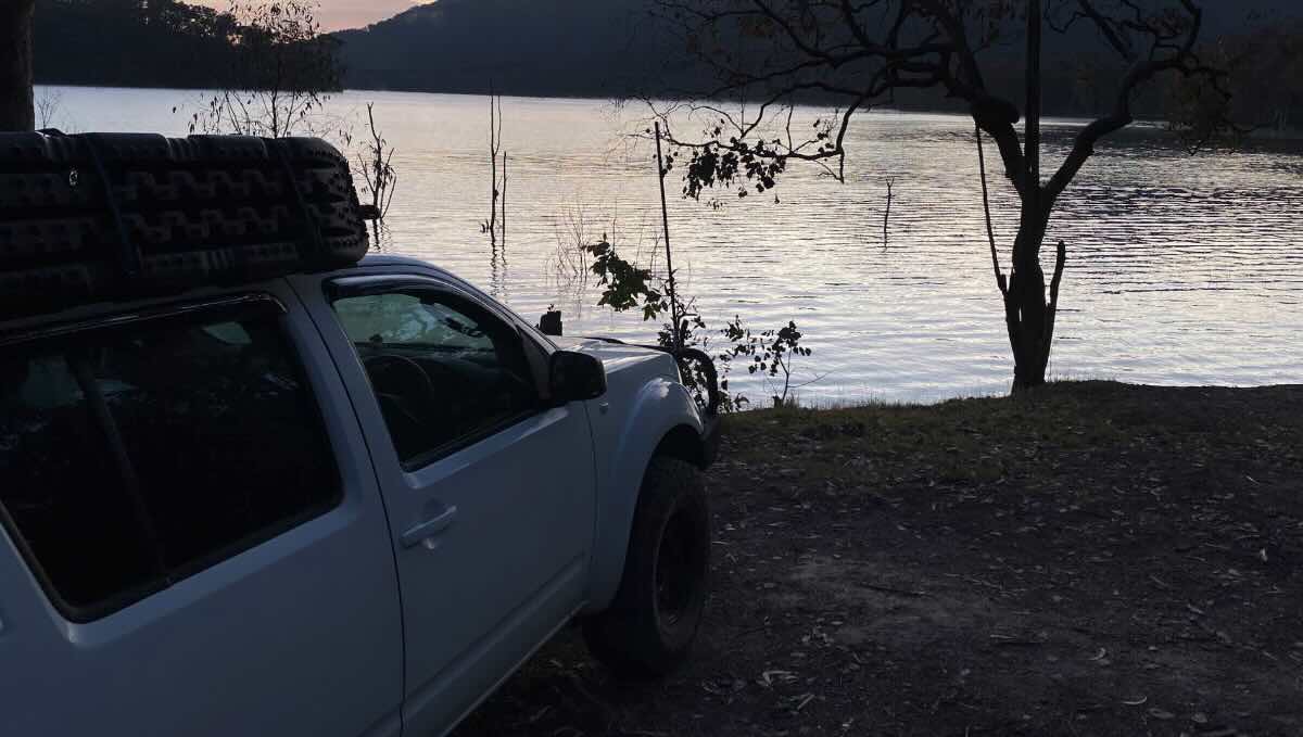
For a classic and wonderfully scenic free camping experience in the Victorian High Country, Coopers Campground is a fantastic choice. Located within the magnificent Howqua Hills Historic Area, this peaceful reserve offers a serene escape on the banks of the iconic Howqua River. It’s an ideal spot for families, anglers, and self-sufficient travellers looking to immerse themselves in the natural beauty and rich heritage of “The Man from Snowy River” country. The campground is a lovely, open, grassy flat, surrounded by the towering, forest-clad hills of the valley. It provides a good number of level, unmarked sites suitable for tents, camper trailers, and small to medium-sized off-road caravans, with many spots offering direct access to the river.
The main appeal of Coopers is its beautiful, tranquil setting. The crystal-clear Howqua River, with its gentle flow and pebbly beaches, is perfect for a refreshing swim, a leisurely paddle in a kayak, or simply relaxing by the water’s edge. The river is also a renowned trout fishing stream, attracting keen anglers. The campground is steeped in the history of the gold rush and cattlemen eras, and it serves as an excellent point on the Howqua Hills Historic Walk, which links several heritage sites along the river. While it is a free, back-to-basics camp, it is equipped with essential non-flush toilets. Its location along the Howqua Hills Road places it conveniently between other popular camps like Sheepyard Flat and Bulldog Flat, and it serves as a great base for exploring the area’s numerous 4WD tracks and scenic drives. For a memorable, budget-friendly adventure that truly captures the spirit of the High Country, Coopers Campground is a delightful and highly recommended destination.
Coopers Campground – VIC Location Map
Campground Information
-
- Name: Coopers Campground
- Address: R2F2+8R, Howes Creek VIC 3723 (Located on Howqua Hills Rd)
- GPS: -37.17918316349768, 146.00310029999957
- Website: This is a free campground in a Historic Area managed by Parks Victoria. Information is available on the Parks Victoria website.
Location Map
Site Details
- Location: Riverside bush camp in the Howqua Hills Historic Area.
- Site Suitable For: Tents, Camper Trailers, and small Off-road Caravans/Motorhomes.
- Road Access: Unsealed gravel road (Howqua Hills Rd). Generally 2WD accessible with care in dry conditions, but can be corrugated and narrow.
- Site Surface: Mostly grass and dirt.
- Camping Permitted: Yes, free camping.
- Maximum Overnight Stays: Please observe Parks Victoria guidelines.
- Facilities: Non-flush toilets, shared fire pits. No power or showers.
- Potable Water: No. You must bring your own drinking water or have a reliable purification system.
- Mobile Phone Coverage: Very poor to non-existent.
- TV Reception: Unlikely.
- Onsite Public Toilets: Yes, non-flush (pit) toilets.
- Rubbish Bins: No. This is a strict carry-in, carry-out site.
- Open Fires: Permitted in designated fire pits only, subject to seasonal fire restrictions. BYO firewood.
- Generator Use: Permitted, but please be considerate of the natural setting and other campers.
- Number of Sites Available: Medium-sized area with a good number of unmarked sites.
- Essentials to Bring: Drinking water, firewood, rubbish bags, toilet paper, insect repellent, fishing gear.
- Pet Friendly: Yes, pets are welcome on a lead.
Activities
- Fishing: Excellent trout fishing in the Howqua River.
- Short Walks: The Howqua Hills Historic Walk connects several campgrounds and heritage sites.
- 4WD Touring: A great base for exploring the vast network of High Country tracks.
Local Amenities
- Local Pubs:
- The Kevington Hotel (Kevington) – Approx. 6 km
- The Jamieson Hotel (Jamieson) – Approx. 22 km
- The Courthouse Hotel (Jamieson) – Approx. 22 km
- Places to Eat:
- The Kevington Hotel (Bistro) – Approx. 6 km
- Jamieson Brewery & Grill – Approx. 22 km
- Numerous options in Mansfield – Approx. 38 km
- Local Attractions:
- Howqua Hills Historic Area & Fry’s Hut – You are in it!
- Craig’s Hut (via 4WD track) – Approx. 32 km
- Mount Buller & Mount Stirling – Accessible via nearby 4WD tracks
- Lake Eildon (Goughs Bay) – Approx. 22 km
- Nearest Caravan Parks:
- Jamieson Caravan Park – Approx. 22 km
- Mansfield Holiday Park – Approx. 38 km
- Next Free Camps:
- Sheepyard Flat and Bulldog Flat (along the same road).
- Nearest Dump Points:
- Mansfield Public Dump Point – Approx. 38 km
- Nearest Petrol Station:
- Jamieson (check hours) – Approx. 22 km
- Mansfield has multiple 24-hour options – Approx. 38 km
- Drinking Water Resupply:
- Available in Jamieson or Mansfield.
- Public Toilets:
- Available onsite (non-flush).
Seasonal Weather Forecast
- Summer (Dec-Feb): Warm to hot days with cool mountain nights, perfect for swimming. Averaging 12-28°C.
- Autumn (Mar-May): Mild, sunny days and cool nights, the peak season for autumn foliage and 4WDing. Averaging 7-22°C.
- Winter (Jun-Nov): Cold, with frequent frosts and a high chance of snow. Roads can be subject to seasonal closures.
- Spring (Nov-Dec): Cool to mild as tracks reopen, with rivers running high. Averaging 5-19°C.