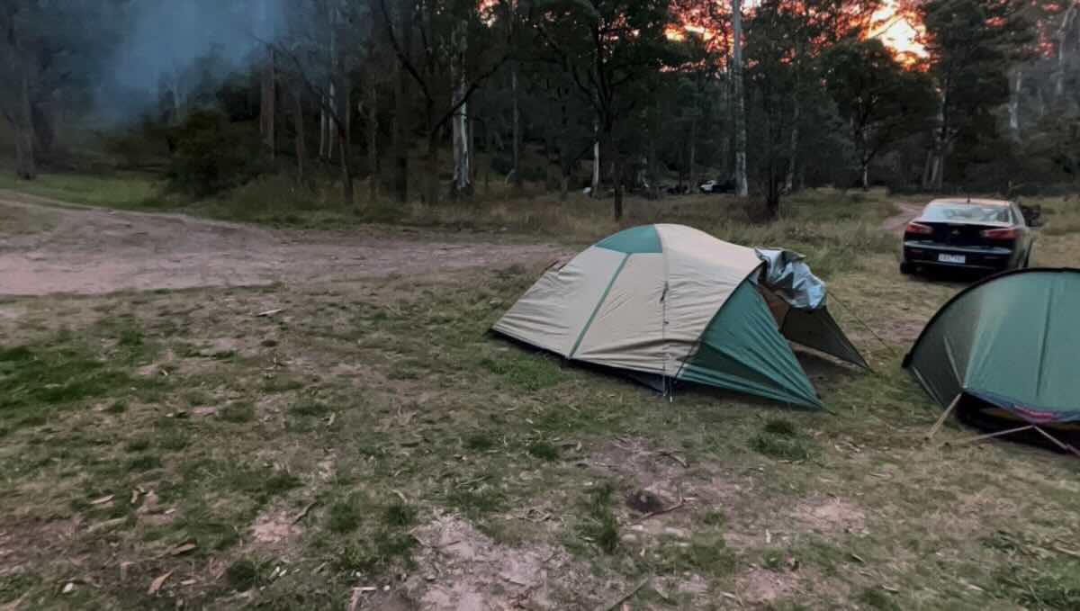
Upper Howqua Campground, Remote High Country 4WD & Fishing Camp
For the dedicated and well-equipped 4WD adventurer, the Upper Howqua Campground is the pinnacle of remote, free camping in the Victorian High Country. This spectacular and challenging-to-access destination offers a true wilderness experience, placing campers deep within the Alpine National Park on the pristine upper reaches of the iconic Howqua River. This is not a destination for the faint-hearted; the journey requires navigating steep, rocky, and often difficult 4WD tracks with multiple river crossings, making it a prized location for serious off-road enthusiasts. The reward is an unparalleled sense of seclusion in a breathtakingly beautiful valley, surrounded by the towering peaks of the alpine region. The campground itself is a series of informal, grassy clearings along the river, perfect for tents, swags, and rugged off-road camper trailers.
The main allure of the Upper Howqua is its magnificent isolation and its role as a gateway to some of the most legendary High Country locations. It serves as the closest camping base for the iconic Picture Point, and from here, adventurers can tackle the challenging tracks leading towards Mount Buller and other remote destinations. The crystal-clear Howqua River, which tumbles through the valley, is a premier trout fishing stream and offers bracingly cold pools for a summer dip. As a true wilderness camp, it demands complete self-sufficiency. There are no facilities, reinforcing the need for campers to be fully prepared and to practice strict leave-no-trace principles. The profound silence, broken only by the sound of the river and the calls of native wildlife, combined with the brilliant, unpolluted starry nights, makes this an unforgettable experience. For a top-tier adventure that captures the rugged, untamed spirit of the high country, the Upper Howqua Campground is a bucket-list destination.
Upper Howqua Campground – VIC Location Map
Campground Information
-
- Name: Upper Howqua Campground
- Address: Upper Howqua Rd, Mount Buller VIC 3723
- GPS: -37.173507460730455, 146.5589663458432
- Website: This is a free campground in a National Park. Information is available on the Parks Victoria website.
Location Map
Site Details
- Location: Remote riverside bush camp in the Alpine National Park.
- Site Suitable For: Tents, Swags, and rugged Off-road Camper Trailers.
- Road Access: Very difficult 4WD tracks only. Multiple river crossings, steep, rocky, and slippery sections. Vehicle recovery gear and extensive experience are essential. Tracks are subject to seasonal closures.
- Site Surface: Natural grass and dirt base.
- Camping Permitted: Yes, free camping.
- Maximum Overnight Stays: Please observe Parks Victoria guidelines.
- Facilities: None.
- Potable Water: No. You must bring all your own water or have a reliable purification system.
- Mobile Phone Coverage: Non-existent. A satellite phone or personal locator beacon (PLB) is essential.
- TV Reception: Not applicable.
- Onsite Public Toilets: No. You must have your own toilet and remove all waste.
- Rubbish Bins: No. This is a strict carry-in, carry-out site.
- Open Fires: Permitted in a contained fire pit, subject to seasonal fire restrictions. BYO firewood.
- Generator Use: Permitted, but be considerate of the wilderness values.
- Number of Sites Available: Multiple unmarked, dispersed sites.
- Essentials to Bring: PLB/Sat Phone, extra fuel, all water and food, full vehicle recovery gear, shovel, firewood, rubbish bags, own toilet.
- Pet Friendly: No. Pets are not permitted in the Alpine National Park.
Activities
- Fishing: Excellent trout fishing in the Howqua River.
- Short Walks: This is a remote hiking area for experienced bushwalkers only.
- 4WD Touring: A premier destination for accessing the most challenging High Country tracks.
Local Amenities
- Local Pubs:
- The Kevington Hotel (Kevington) – Approx. 40 km
- The Jamieson Hotel (Jamieson) – Approx. 55 km
- The Hunt Club Hotel (Merrijig) – Approx. 60 km
- Places to Eat:
- The nearest reliable options are in Mansfield (approx. 70 km) or Jamieson (approx. 55 km).
- Local Attractions:
- Picture Point Lookout – Nearby via 4WD track
- Craig’s Hut – Approx. 25 km via 4WD tracks
- Mount Buller & Mount Stirling – Accessible via 4WD tracks
- Nearest Caravan Parks:
- Jamieson Caravan Park – Approx. 55 km
- Mansfield Holiday Park – Approx. 70 km
- Next Free Camps:
- Pineapple Flat (downriver, easier access) – Approx. 15 km
- Sheepyard Flat – Approx. 25 km
- Nearest Dump Points:
- Mansfield Public Dump Point – Approx. 70 km
- Nearest Petrol Station:
- Mansfield has multiple 24-hour options – Approx. 70 km
- Drinking Water Resupply:
- Available in Mansfield or Jamieson.
- Public Toilets:
- The nearest public toilets are at Pineapple Flat. You must have your own at this site.
Seasonal Weather Forecast
- Summer (Dec-Feb): Warm days with cool mountain nights. Averaging 10-26°C. Be prepared for sudden storms.
- Autumn (Mar-May): Mild, clear days and cold nights. The prime season for 4WDing. Averaging 5-20°C.
- Winter (Jun-Nov): Cold, snow-covered, and inaccessible. Roads are seasonally closed.
- Spring (Nov-Dec): Cool to mild as tracks reopen, with rivers running high and potentially dangerous to cross. Averaging 4-18°C.