Wild Dog Creek Falls Campground, Mount Samaria State Park Hike-in Camp
For a truly immersive and rewarding bushwalking adventure, the Wild Dog Creek Falls Campground is a spectacular hike-in only destination within the beautiful Mount Samaria State Park. This is a campground for the dedicated hiker, offering a serene and secluded experience deep within the High Country forest. Nestled in a tranquil gully, this Parks Victoria site provides the ultimate escape, where the only sounds are the cascading waterfall, the rustle of wildlife, and the chorus of native birds. The campground is designed for tent-based camping, with a series of well-defined sites that offer a sense of privacy and a direct connection to the stunning natural surroundings. The journey to the campsite is an integral part of the experience, requiring a moderate hike that rewards walkers with magnificent forest scenery and a profound sense of accomplishment upon arrival.
The main attraction is the campground’s stunning natural setting, located right near the beautiful Wild Dog Creek Falls. It’s the perfect base for exploring the park’s extensive network of walking tracks, including the challenging trail to the summit of Mount Samaria, which offers breathtaking panoramic views of the surrounding ranges and valleys. The area is a haven for nature lovers, with the diverse forest environment supporting a rich variety of wildlife, including kangaroos, wallabies, and numerous bird species. As a remote, hike-in campground, bookings are essential, and campers must be completely self-sufficient. The facilities are basic but well-maintained, befitting a wilderness setting. While it feels a world away from civilisation, it remains accessible for a weekend adventure from nearby towns like Mansfield and Benalla. For an authentic and unforgettable High Country hiking and camping experience, Wild Dog Creek Falls is a top-tier destination.
Wild Dog Creek Falls Campground – VIC Location Map
Campground Information
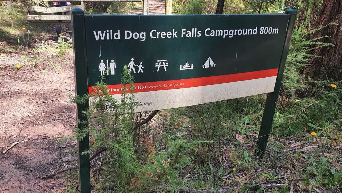
- Name: Wild Dog Creek Falls Campground
- Address: Mt Samaria Track, Bridge Creek VIC 3723 (Hike-in only)
- GPS: -36.86491257809349, 146.07191616987035
- Website: Parks Victoria – Wild Dog Creek Falls
Location Map
Site Details
- Location: Hike-in only campground in Mount Samaria State Park.
- Site Suitable For: Tents and swags only.
- Road Access: No vehicle access to the campground. Accessible via a 1.5km walk from the Mount Samaria Road carpark.
- Site Surface: Natural dirt and leaf litter base.
- Camping Permitted: Yes, bookings and fees are mandatory via the Parks Victoria website.
- Maximum Overnight Stays: Check Parks Victoria guidelines.
- Facilities: Non-flush toilets, shared fire pits. No power or showers.
- Potable Water: No. You must bring all your own drinking water.
- Mobile Phone Coverage: Non-existent. A personal locator beacon (PLB) is highly recommended.
- TV Reception: Not applicable.
- Onsite Public Toilets: Yes, non-flush (pit) toilets.
- Rubbish Bins: No. This is a strict carry-in, carry-out site.
- Open Fires: Permitted in designated fire pits only, subject to seasonal fire restrictions. Fuel stoves are recommended.
- Generator Use: Not permitted.
- Number of Sites Available: 5 designated, bookable sites.
- Essentials to Bring: All hiking and camping gear, food, water purification system, PLB, rubbish bags.
- Pet Friendly: No. Pets are not permitted in Mount Samaria State Park.
Activities
- Fishing: Not applicable.
- Short Walks: This is a premier hiking destination, with access to the Mount Samaria Summit Walk and the falls trail.
- Wildlife Watching: Excellent opportunities to see kangaroos, wallabies, and diverse birdlife.
Local Amenities
- Local Pubs:
- Tolmie Tavern (Tolmie) – Approx. 25 km
- The Commercial Hotel (Mansfield) – Approx. 30 km
- The Mansfield Hotel – Approx. 30 km
- Places to Eat:
- Tolmie Tavern (Bistro) – Approx. 25 km
- Numerous cafes, bakeries, and restaurants in Mansfield – Approx. 30 km
- Local Attractions:
- Mount Samaria Summit – Accessible from the campground
- Stringybark Creek Historic Reserve (Ned Kelly Site) – Approx. 10 km
- Powers Lookout – Approx. 35 km
- Nearest Caravan Parks:
- Mansfield Holiday Park – Approx. 30 km
- Benalla Tourist Park – Approx. 35 km
- Next Free Camps:
- Stringybark Creek Camping Area – Approx. 10 km
- Tolmie Recreation Reserve – Approx. 25 km
- Nearest Dump Points:
- Mansfield Public Dump Point – Approx. 30 km
- Nearest Petrol Station:
- Mansfield has multiple 24-hour options – Approx. 30 km
- Drinking Water Resupply:
- Available in Mansfield or Benalla.
- Public Toilets:
- Available onsite (non-flush).
Seasonal Weather Forecast
- Summer (Dec-Feb): Warm days with cool mountain nights. Averaging 14-30°C.
- Autumn (Mar-May): Mild, sunny days and cool nights, ideal for hiking. Averaging 8-23°C.
- Winter (Jun-Aug): Cold, with frequent frosts and a chance of snow on the summit. Averaging 2-13°C.
- Spring (Sep-Nov): Cool to mild, with the forest green and lush, but weather can be very changeable. Averaging 6-20°C.