Hutchesson’s Camp Site, Glenelg River Bush Camping & Great South West Walk
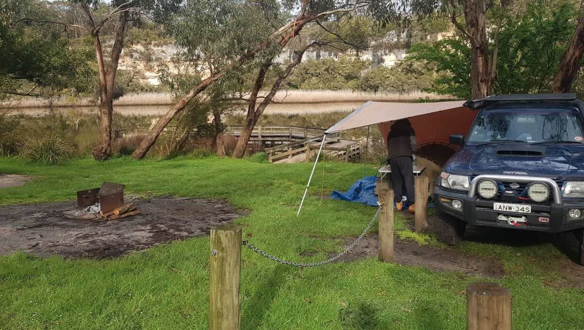
For a truly immersive and remote bush camping experience, Hutchesson’s Camp Site is a spectacular destination nestled deep within the Lower Glenelg National Park. This beautiful Parks Victoria campground offers a serene escape on the banks of the majestic Glenelg River, making it a paradise for canoers, kayakers, anglers, and hikers. The campground is set in a beautiful, shaded clearing surrounded by dense native forest, providing a genuine sense of being away from it all. The designated sites are well-spaced, offering privacy and allowing campers to fully appreciate the tranquil environment, where the primary soundtrack is the chorus of native birdlife and the gentle lapping of the river. It’s a classic back-to-basics bush camp that rewards self-sufficient travellers with an unforgettable nature-based adventure.
The main attraction is the magnificent Glenelg River itself. Hutchesson’s has its own small jetty, providing direct access to the water for launching a canoe or kayak to explore the stunning limestone gorges that the river is famous for. The fishing here is exceptional, with the river renowned for its healthy populations of Bream, Mulloway, and Estuary Perch. The campground is also a key overnight stop for those tackling the iconic Great South West Walk, a 250-kilometre trail that winds through the region’s diverse landscapes. While the facilities are simple, they are well-maintained and perfect for the rustic setting. Bookings are essential to secure a spot in this popular yet secluded location. For those looking to explore the wild beauty of Victoria’s far south-west and experience one of its most impressive river systems, Hutchesson’s Camp Site is a top-tier destination.
Hutchesson’s Camp Site – VIC Location Map
Campground Information
-
- Name: Hutchesson’s Camp Site
- Address: River Fire Ln, Mumbannar VIC 3304 (within Lower Glenelg National Park)
- GPS: -37.998337229592074, 141.04706872288392
Location Map
Site Details
- Location: Secluded riverside camp in the Lower Glenelg National Park.
- Site Suitable For: Tents, Camper Trailers, and small Campervans. Not suitable for caravans or large motorhomes.
- Road Access: Unsealed gravel/dirt road (Hutchesson’s Track). Can be rough and slippery when wet. 4WD is often recommended.
- Site Surface: Natural dirt and gravel base.
- Camping Permitted: Yes, bookings and fees are mandatory via the Parks Victoria website.
- Maximum Overnight Stays: Check Parks Victoria guidelines for booking limits.
- Facilities: Non-flush toilets, shared fire pits, picnic tables, river jetty. No power or showers.
- Potable Water: No. You must bring all your own drinking water (or treat river water).
- Mobile Phone Coverage: Very poor to non-existent.
- TV Reception: Unlikely.
- Onsite Public Toilets: Yes, non-flush (pit) toilets.
- Rubbish Bins: No. This is a strict carry-in, carry-out site.
- Open Fires: Permitted in designated fire pits only, subject to seasonal fire restrictions. BYO firewood.
- Generator Use: Not permitted.
- Number of Sites Available: 6 designated, bookable sites.
- Essentials to Bring: Drinking water, firewood, rubbish bags, toilet paper, insect repellent, kayak/canoe.
- Pet Friendly: No. Pets are not permitted in the Lower Glenelg National Park.
Activities
- Fishing: Excellent river fishing for Bream, Mulloway, and Estuary Perch.
- Short Walks: This is a key campground on the multi-day Great South West Walk.
- Kayaking & Canoeing: A premier destination for paddling the Glenelg River.
Local Amenities
- Local Pubs:
- Nelson Hotel (Nelson) – Approx. 20 km
- Dartmoor Hotel (Dartmoor) – Approx. 25 km
- Port Macdonnell Hotel (SA) – Approx. 45 km
- Places to Eat:
- Nelson Hotel (Bistro) & Kiosk – Approx. 20 km
- Dartmoor Hotel (Bistro) – Approx. 25 km
- Local Attractions:
- Great South West Walk – Onsite
- Princess Margaret Rose Cave – Approx. 15 km
- Town of Nelson and Glenelg River Mouth – Approx. 20 km
- Piccaninnie Ponds Conservation Park (SA) – Approx. 35 km
- Nearest Caravan Parks:
- Kywong Caravan Park (Nelson) – Approx. 20 km
- Fort O’Hare Free Camp (Dartmoor) – Approx. 25 km
- Next Free Camps:
- Fort O’Hare (Dartmoor) – Approx. 25 km
- Greenwald State Forest (various sites) – Approx. 30 km
- Nearest Dump Points:
- Nelson Public Dump Point – Approx. 20 km
- Nearest Petrol Station:
- Nelson – Approx. 20 km
- Dartmoor – Approx. 25 km
- Drinking Water Resupply:
- Available in Nelson.
- Public Toilets:
- Available onsite (non-flush).
Seasonal Weather Forecast
- Summer (Dec-Feb): Warm and generally dry, with moderating coastal influences, averaging 14-27°C.
- Autumn (Mar-May): Mild, pleasant days and cool nights, ideal for walking and kayaking, averaging 9-22°C.
- Winter (Jun-Aug): Cool and often damp, with chilly days, averaging 6-15°C.
- Spring (Sep-Nov): Cool to mild with increasing sunshine, a great time to see the forest and river come to life, averaging 8-20°C.